When we hear news about earthquakes or volcanoes, we catch the phrase “the ground is moving” in passing. Mountains and seas seem to stay in the same place forever, but Earth’s surface is in fact slowly sliding. The theory that explains this big picture, in which continents split apart and collide to form mountain ranges and trenches, is “plate tectonics.”
Put simply, plate tectonics is the theory that “Earth’s outer shell is divided into several rigid plates, and as those plates move over a weaker layer, they cause geological phenomena such as earthquakes, volcanoes, and mountain ranges.” After Alfred Wegener proposed continental drift in 1912, research on seafloor spreading and paleomagnetism in the 1960s lent it support, and it was established as today’s theory of plate tectonics.
This article lays out, in an easy-to-understand way, everything from the basic definition of plate tectonics to the structure of the lithosphere and asthenosphere, the three types of plate boundaries, and what it means for daily life and disaster preparedness.
Plate Tectonics: The Blueprint of Earth’s Moving Surface
What Is Plate Tectonics?
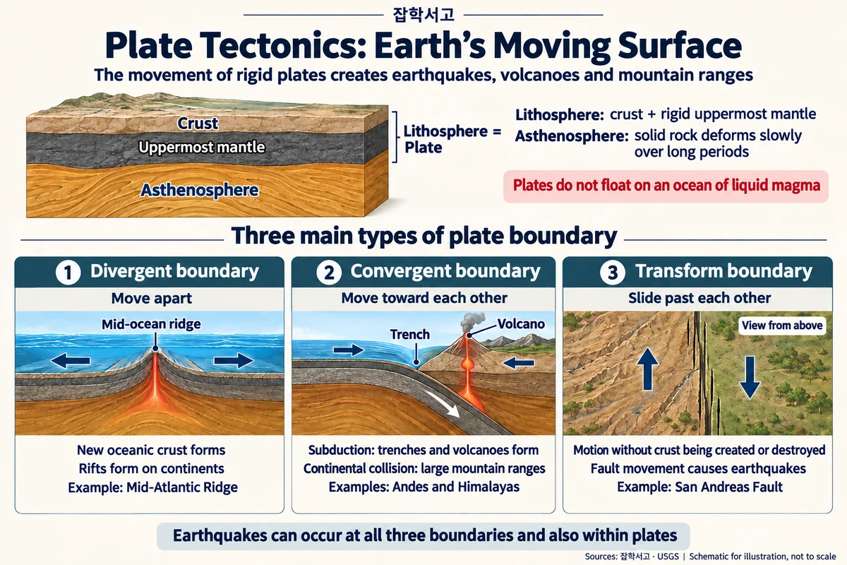
If we compare Earth to an egg, the hard outer shell is the lithosphere, and the soft egg white beneath it is close to the asthenosphere. The lithosphere is a rigid layer made up of the crust and the uppermost mantle, and this layer is broken into several pieces called “plates.” The plates move slowly over the asthenosphere at a few centimeters per year. That is about the rate at which human fingernails grow, but over millions of years it changes the positions of the continents.
What this theory explains at its core is not “phenomena” but causes and connections. Why earthquakes cluster along particular belts, why deep trenches and volcanic arcs form side by side near coastlines, why there is a ridge in the middle of the Atlantic: the movement of the plates draws that map.
Related concepts worth keeping in mind are as follows.
- Lithosphere: the rigid outer shell made up of the crust and the upper mantle.
- Asthenosphere: the partially fluid mantle layer beneath it.
- Continental and oceanic plates: plates that include thick continental crust, and plates made mainly of thin oceanic crust.
- Convection: the circulation of heat inside the mantle, understood as a driving force that moves the plates.
The Forces That Move Plates and Earth’s Layered Structure
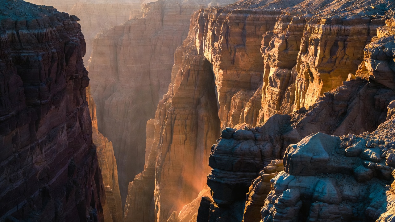
The force that drives plate movement cannot be explained by a single cause. However, the mechanisms that often appear in textbooks and research are as follows.
(1) Mantle Convection
This is the classic explanation that hot material deep in the mantle rises while cooled material sinks, and this circulation drags the plates along. The actual flow is more complicated than a simple conveyor belt, but the broad idea that “heat creates motion” still holds.
(2) Ridge Push and Slab Pull
Two forces are important: the force that pushes outward to both sides as new oceanic crust forms at mid-ocean ridges (ridge push), and the force that pulls a plate as cold oceanic lithosphere sinks downward at a subduction zone (slab pull). Many researchers regard slab pull as a particularly strong driving force.
(3) Plate Types and Density
Oceanic plates are generally colder and heavier, so they tend to subduct beneath continental plates. This difference in density creates the pattern of where mountain ranges, trenches, and volcanic arcs are located.
As a simple analogy, picture pieces of cracker floating on warm soup, carried along and sliding as the broth slowly circulates beneath them. The crackers (plates) are rigid, while the broth (the asthenosphere and mantle) flows slowly.
Three Types of Plate Boundaries
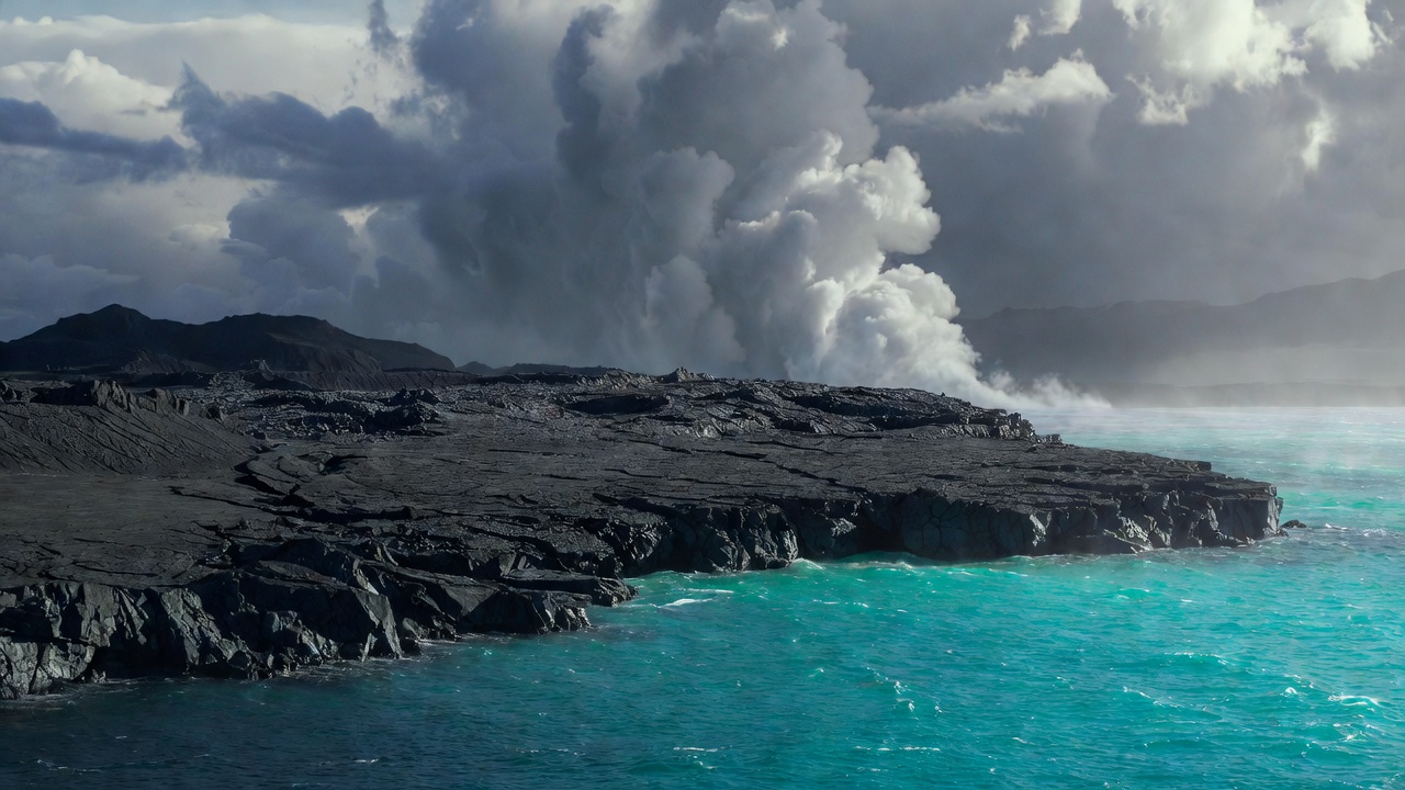
Depending on how plates meet, boundaries fall into three broad types.
(1) Divergent Boundary
Two plates move away from each other. At mid-ocean ridges, magma wells up to form new oceanic crust, and on continents, rift valleys can appear. In some places, such as Iceland, a ridge is exposed above sea level.
(2) Convergent Boundary
Two plates collide. At subduction zones, where an oceanic plate slides beneath a continental plate, deep trenches and volcanic arcs form; when continent meets continent, enormous mountain ranges like the Himalayas grow. Strong earthquakes often accompany them.
(3) Transform (Conservative) Boundary
Two plates slide past each other sideways. Crust is neither newly created nor destroyed, but friction can cause large earthquakes. The San Andreas Fault is a representative example.
If you spread out a map of the world’s earthquakes and volcanoes, it almost overlaps with the belts drawn by these three boundaries. Plate tectonics is also a map that explains “why disasters happen there.”
Plate Tectonics in Daily Life and Disaster Preparedness

Plate tectonics does not stay a classroom theory. From tsunami warning zones and earthquake-resistant design for nuclear plants and high-rise buildings to the routes of undersea communication cables and resource exploration, “how the plates meet” forms the background for decisions. Near subduction zones, where an oceanic plate slides beneath a continental plate, earthquakes and volcanic activity tend to occur in chains, and knowing that pattern is the starting point for deciding where to place monitoring networks and evacuation plans. Korea lies somewhat far from plate boundaries, so very large earthquakes are infrequent, but the movement of surrounding plates and the effects of distant earthquakes and tsunamis cannot be ignored.
Points worth remembering as you read are as follows.
- Plates never stop. Their movement is slow, but when stress builds up faults slip all at once.
- “Safe zones” are relative. The shorter a region’s historical records and measurements, the more dangerous overconfidence becomes.
- The theory keeps getting more refined. GPS measures plate speeds in real time, and deep seismic waves scan the structure of the mantle.
Plate tectonics shows that Earth is not a dead lump of rock but a living, moving system. Understanding that the ground beneath our feet is slowly sliding, and making disaster information and preparedness part of our daily habits, is the first step in connecting earth science to our lives.